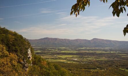


Michigans Inland Waterway offers one of the most structured and accessible boating routes in the northern tip of the Lower Peninsula. This unique chain of lakes and rivers allows boaters to travel across the “mitten” from near Petoskey all the way to Lake Huron.Stretching roughly 38 miles, this chain of rivers and lakes connects Crooked Lake to Lake Huron through a series of clearly marked channels and inland lakes.
For first-time boaters, the appeal is simple: protected waters, manageable distances, and steady access to fuel, food, and safe harbor. But the route still demands planning. Narrow channels, strict speed zones, and changing weather near Lake Huron can catch newcomers off guard.
This guide lays out what to expect, how to prepare, and how to complete the trip safely.
Table of Contents – Michigans Inland Waterway
Route Overview: What You’re Navigating
The northern Michigan inland waterway follows a defined path:
- Start: Crooked Lake
- Flow through: Crooked River
- Continue into: Burt Lake
- Flow though: Indian River
- Pass into: Mullett Lake
- Exit via: Cheboygan River
- End at: Lake Huron
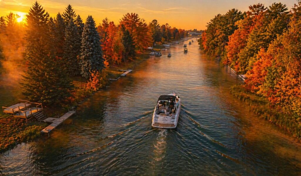
The system combines narrow, controlled channels with wide inland lakes. Travel time ranges from 4 to 8 hours depending on speed limits, stops, and traffic.
Planning Your Trip
Timing matters on the Michigan waterways system. The boating season typically runs from late May through early October, with July and August bringing the most traffic.
- Best conditions: Early mornings with light wind
- Boat type: Pontoon boats, small cruisers, fishing boats, and kayaks all work well
- Fuel stops: Available along Burt Lake, Mullett Lake, and near Cheboygan
- Trip length: A full-day run or a two-day trip with an overnight stay
Weather shifts quickly as you approach Lake Huron. Calm inland water can give way to waves and wind near the mouth of the Cheboygan River.
Inland Waterways Rules and Regulations
Understanding inland waterways rules and regulations is not optional. This route is closely managed, and enforcement is active.
- No-wake zones: Common in narrow channels and near docks
- Speed limits: Strictly enforced, especially in the Indian River corridor
- Navigation markers: Follow them closely; shallow areas sit just outside marked channels
- Safety gear: Life jackets required for each passenger
- Lights and signals: Required for low visibility and evening travel
A key control point is the Alanson Lock. Operators guide boats through at idle speed. Expect short waits during peak hours.
Failure to follow posted rules is the most common issue for first-time visitors.
Step-by-Step: Running the Waterway
Crooked Lake to Burt Lake via Crooked River

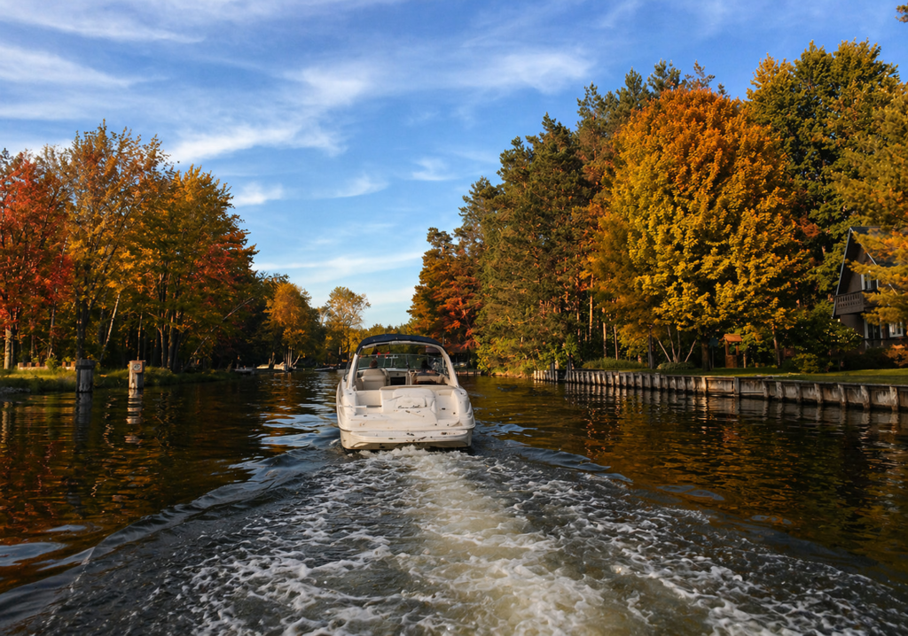
This stretch sets the tone. Channels are narrow, traffic can be heavy, and speed is controlled.This opening stretch of the northern Michigan inland waterway sets the tone for the entire trip. It is controlled, narrow, and requires attention from the moment you leave Crooked Lake near Oden.
Channel Conditions and Boat Handling
The route quickly funnels into the Crooked River, one of the tightest sections of the system. Expect:
- Narrow, winding channels with limited passing room
- Heavy seasonal traffic
- Strict slow-speed and no-wake enforcement
Michigan law specifically requires slow-no wake speeds in sections of the Crooked River, particularly near Alanson and connecting channels, to reduce shoreline damage and maintain safe navigation.
Staying centered between navigation markers is critical. Shallow areas sit just outside the channel.
Boat Size and Navigation Limits
While the Inland Waterway can technically handle larger vessels, real-world navigation on this section is more restrictive.
- The system overall can accommodate boats up to about 60–65 feet
- Crooked River navigation is generally limited to boats around 25 feet due to tight bends and narrow passages
This is why smaller cruisers, pontoons, and fishing boats are most common on this stretch.
The Crooked River Lock Before Alanson: First Major Checkpoint

The Crooked River Lock connects the Crooked River to Burt Lake and manages water levels between the systems.
- The lock exists to regulate lake levels after mid-20th-century dredging lowered Crooked and Pickerel Lakes
- Thousands of vessels pass through annually, making it one of the busiest recreational locks in the region
- Water level changes are typically modest but controlled during each passage
Lock Procedure and Authority
Federal regulations govern how vessels move through the lock.
- The lockmaster has full authority over all boat movement in the lock and approach areas
- Boats must follow instructions and cannot proceed without direction
- Controlled entry, mooring, and exit procedures are required for every vessel
In practical terms:
- Approach at idle speed
- Wait for signal or instruction
- Keep hands and gear clear of lock walls
- Maintain control of lines if tied off
Transition Into Burt Lake
Once you clear the Alanson Lock, the pace changes. This section of the northern Michigan inland waterway mixes tight navigation with easy shore access, local stops, and some of the better fishing water on the route. The distance to Burt Lake is short, but there is a lot packed into it.
Alanson: First Stop After the Lock
Just north of the lock sits the small village of Alanson. It serves as a practical stop for fuel, food, and a short break.
- The village is home to what is often billed as the world’s shortest swing bridge
- Early versions required manual operation with a hand crank, reflecting its mid-20th-century design
- A public park just north of the bridge offers free docking and easy access to downtown
- Fresh spring water is available at the dock area
This is one of the few places along the Crooked River where first-time boaters can step off, regroup, and walk to restaurants within minutes. It is also one of the safest places to bring children ashore for a break.
M-68 Bridge: Shelter and Structure
A short run north brings you under the M-68 Bridge.
- The bridge provides temporary cover during rain
- Water depth and structure make it a reliable fishing spot
- Common catches include rock bass, walleye, and northern pike
Just north of the bridge on the west shore sits an older boathouse dating back to the logging era, when Alanson served as a working river town. Early crossings in this area were far simpler, often built from large timber logs.
Hay Lake Section: Straight Channel, Shallow Water
This portion of the Crooked River is commonly referred to as Hay Lake, though today it is a dredged channel.
- Before dredging, this area spread into a shallow inland lake
- The modern channel runs straight with marshland on both sides
- Average depth is about six feet, with soft bottom conditions
Fishing here is productive if approached correctly:
- Walleye: Target edges using shallow-running crankbaits
- Bass: Early morning topwater in side ponds
- Pike: Spinnerbaits in the afternoon along weed lines
The east-side backwater areas are better suited to smaller craft like canoes or kayaks due to limited depth and tight access.
Scenic Stretch North of Hay Lake
This is one of the quieter and more visually appealing parts of the Michigan waterways system.
- Cedar and birch trees line the banks
- Small feeder creeks create sandbars and natural breaks
- Wildlife sightings are common, including deer along the shoreline
Several sandbars provide safe, informal stopping points. Many boaters pause here for short breaks, but footing can be soft and uneven.
Shore Access and Road Crossings
This stretch is accessible by road in a few locations:
- Mission Road (south access)
- Snyder Road (north access)
- Closest main crossing: M-68 in Alanson
Small boat launches exist, but they are limited in size. Boats over 14 feet are generally not practical for launching in these access points.
Wake Control and Residential Areas
Much of this section passes through residential shoreline.
- Slow speed is required in marked areas
- Wake damage to docks and shorelines is a known issue
- Enforcement is active during peak boating season
Boaters are responsible for any damage caused by excessive wake.
Devil’s Elbow: Tightest Turn on the Route
One of the most difficult navigation points is known locally as Devil’s Elbow.
- The river bends sharply, exceeding a standard 180-degree turn
- Sightlines are limited, making oncoming traffic a concern
- Larger boats must reduce speed and swing wide to clear the turn safely
This section is also part of the Top O’ Michigan Outboard Marathon, where experienced racers navigate the same turn at high speed during annual events.
Final Approach to Burt Lake
As you near Burt Lake, watch for channel markers.
- Marker #73 signals the approach to the lake
- Aligning with marker #71 guides entry into Bullhead Bay
Early morning is often the most productive time in this area:
- Walleye tend to hold near drop-offs on both sides of the channel
- Deer are frequently seen along the shoreline at sunrise
Fishing Tactics
- Use a lead-head jig with a live minnow for walleye
- Cast beyond drop-offs and work the bait through depth changes
- Trolling crankbaits across the 6–8 foot flats in Bullhead Bay can produce both walleye and northern pike
Bottom Line
This section of the northern Michigan waterway is more than a short connector between the lock and Burt Lake. It combines:
- Crooked River is narrow, regulated, and slow-speed controlled
- Practical boat size is limited to about 25 feet in this section
- Conditions change quickly once entering Burt Lake
- The Alanson Lock is a controlled federal facility with strict procedures
Take it slow, watch your wake, and use this stretch as both a learning segment and a chance to stop, fish, and reset before entering the open water of Burt Lake.
This contrast—from tight river navigation to open lake travel—is one of the defining features of the Michigan waterways system.
Burt Lake to Mullett Lake via Indian River

This is the longest open-water segment. Navigation is straightforward, but distance and fuel use become factors.
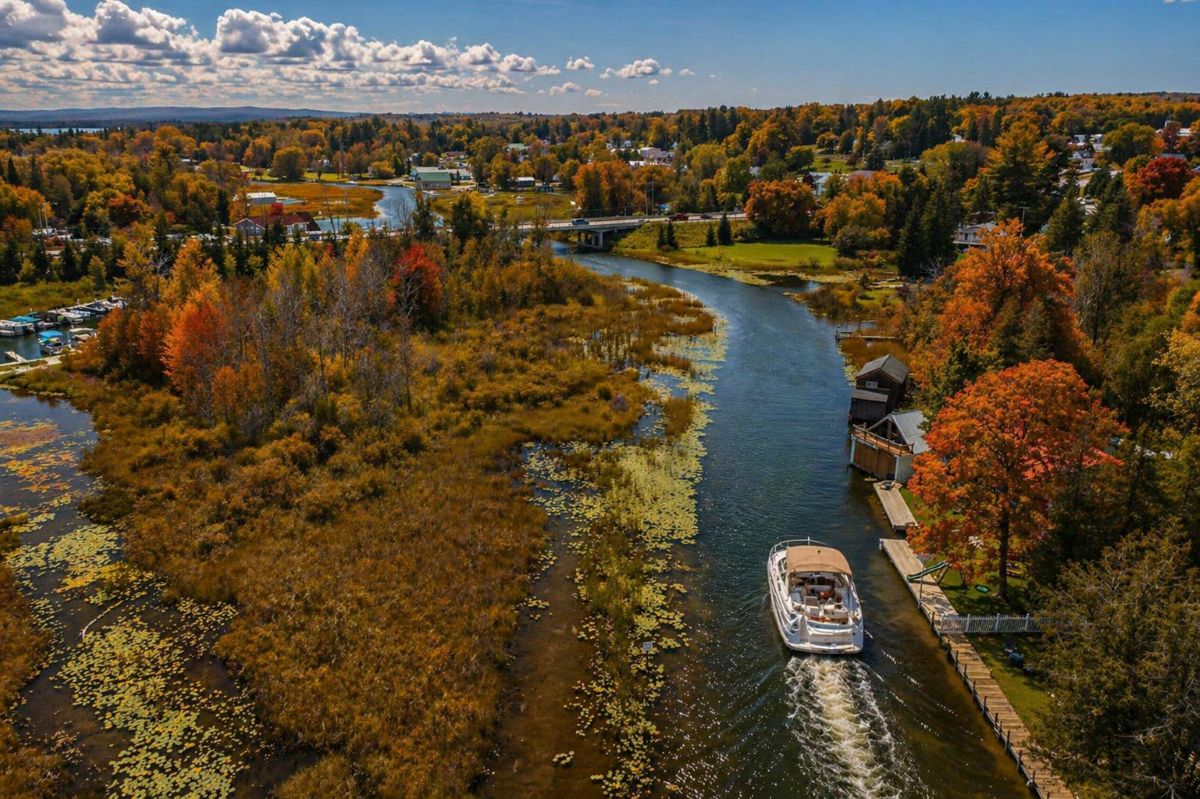
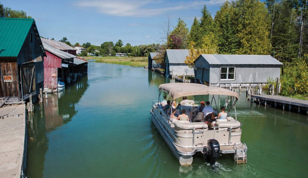
The run from Burt Lake to Mullett Lake through Indian River is one of the busiest and most accessible stretches of the northern Michigan inland waterway. It combines tight river navigation, steady boat traffic, and easy access to fuel, food, and public docks.
Entrance Channel from Burt Lake
The transition out of Burt Lake into the Indian River begins through a clearly defined entrance channel.
- On the south side sits DeVoe Beach Park, a public waterfront with benches, a walkway, and a small beach
- This is one of the most visible gathering points along the waterway
- It also serves as a staging area for local events, including Fourth of July fireworks launched from the nearby pier
Through Downtown Indian River
The Indian River connects the two lakes and runs directly through the center of town.
- Public docking is available near the M-27 Bridge
- Restaurants, shops, and basic services are within walking distance
- This is one of the most convenient stop points along the entire Michigan waterways route
Boating Conditions
- Traffic increases significantly in summer
- Expect congestion near docks, bridges, and marinas
- Maintain slow speed and watch for turning vessels
This is not a section to rush through. Tight spacing and mixed boat sizes require steady control.
Fuel, Supplies, and Services
Between downtown and the I-75 corridor, multiple service points are available:
- Howe Marina
- Indian River Marina
Both offer:
- Fuel docks
- Basic marine supplies
- Limited repair services
Boat traffic entering and exiting these marinas can create sudden slowdowns. Stay alert and reduce speed in these zones.
Modoc Marsh: Wildlife Corridor
Northeast of town, the river widens into marshland commonly referred to as Modoc Marsh.
- Large wetland system with dense vegetation
- Frequent sightings of sandhill cranes and loons
- Bald eagles have been observed nesting in the area
This section offers a break from developed shoreline and is one of the quieter parts of the route, despite its proximity to town.
Access Points and Launch Areas
Several public and private access points exist along this stretch:
- End of Bowersock Road – limited public access
- The Landings Marina – launch ramp, fuel, and store
These locations are useful for smaller craft and support access for anglers and day boaters.
Visual Character of the River
This is one of the more varied sections of the northern Michigan waterway:
- Developed shoreline near town transitions into open marsh
- Seasonal wildflowers line the banks in summer
- Fall brings strong color contrast along the river corridor
The mix of access, activity, and natural features makes it one of the most memorable portions of the trip.
Bottom Line
- Expect heavy traffic near Burt Lake and downtown Indian River
- Use this section for fuel, food, and a break from longer runs
- Fishing is strongest early in the season and during low light
- Conditions shift quickly from developed shoreline to open marsh
Handled correctly, this stretch is both a practical stop and a highlight of the route between Burt Lake and Mullett Lake. Stay aware of changing wind conditions. Even moderate wind can build noticeable chop across open water.
Mullett Lake to Cheboygan River

The route narrows again as you enter the river system. Watch for current and reduced maneuvering space.
Bridges near Cheboygan may require timing or clearance awareness depending on your boat height.
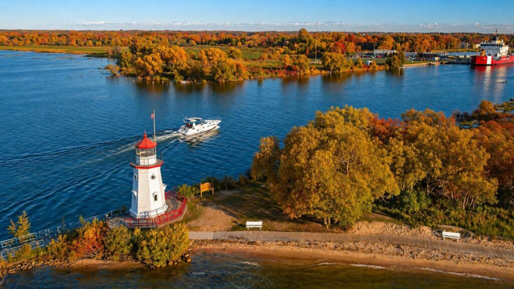
Cheboygan River to Lake Huron

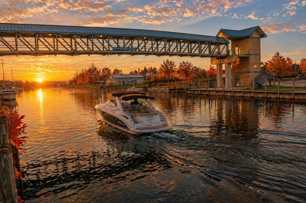
This final stretch brings a shift in conditions. Lake Huron is open water. Wind, waves, and weather patterns are less predictable.
If conditions are rough, many first-time boaters turn back at Cheboygan rather than enter the lake.
Hazards First-Time Boaters Overlook
- Shallow edges: Stray outside markers and you can run aground
- Boat congestion: Especially in the Indian River corridor
- Sudden wind shifts: Common on Burt and Mullett Lakes
- Fatigue: Long stretches at no-wake speed can wear down attention
Staying alert matters more than speed on this route.
Best Stops Along the Route

- Marinas along Burt and Mullett Lakes for fuel and rest
- Public docks in Cheboygan
- Small waterfront restaurants and parks along the waterway
Plan stops ahead of time. Dock space fills quickly during peak season.
Equipment Checklist
- U.S. Coast Guard-approved life jackets
- Marine radio or charged phone
- GPS or navigation app
- Dock lines and fenders
- Extra fuel or a clear refueling plan
- Weather app for real-time updates
Skipping basic gear is one of the most common mistakes made by first-time visitors.
Final Takeaway
The northern Michigan waterway is one of the most structured boating routes in the state. It offers a clear path, reliable services, and manageable distances.
But it is not a casual float. Rules are enforced, channels are tight, and conditions shift as you move east toward Lake Huron.
Plan the route, follow the markers, and respect the regulations. Do that, and your first trip on Michigan’s Inland Waterway will run smoothly from Crooked Lake to open water.
Sources Utilized for this Article
Emmet County. “Crooked River Lock.” Emmet County, accessed 25 Apr. 2026.
Emmet County. “FAQ | Crooked River Locks.” Emmet County, accessed 25 Apr. 2026.
Indian River Chamber of Commerce. “Northern Michigan’s Inland Waterway.” Indian River Chamber of Commerce, accessed 25 Apr. 2026.
Indian River Chamber of Commerce. “Things to Do: Fall.” Indian River Chamber of Commerce, accessed 25 Apr. 2026.
Michigan Department of Natural Resources. “Crooked River Lock 2025 Schedule.” Michigan.gov, accessed 25 Apr. 2026.
Michigan Department of Natural Resources. “Local Watercraft Controls: Emmet County.” Michigan.gov, accessed 25 Apr. 2026.
Legal Information Institute. “33 CFR § 207.476 — Crooked River Lock, Alanson, Mich.; Use, Administration, and Navigation.” Cornell Law School, accessed 25 Apr. 2026.
Fishweb. “Crooked River, Alanson Swing Bridge, Fishing, Boating.” Fishweb, accessed 25 Apr. 2026.
Miller, Dave. “World’s Smallest Operating Swing Bridge, Alanson, Michigan.” Dave Miller’s Adventures, 29 Aug. 2023, accessed 25 Apr. 2026.
Fairbairn Realty Blog. “Alanson Swing Bridge.” Coldwell Banker Fairbairn Realty Blog, 26 Aug. 2021, accessed 25 Apr. 2026.